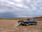
 While Traci was with Michael at Scout daycamp yesterday, Bradley and I did the Coal Wash loop ride on my ATV. The weather was forecast to be 75-80° with a 20-30% chance of showers. That seemed acceptable to me, though considering that we’d be riding in the bottom of canyons with large drainages for most of the ride, I did have some concerns about flash flooding. We left home pretty early and got to the staging area and started riding before 9:00 AM. It was beginning to get overcast, and there were some very dark clouds moving in from the west, but I decided to risk it. The first part of the ride through the main part of Coal Wash was pretty boring because I’ve been through there so many times recently, although that part of the canyon isn’t terribly scenic anyway–the really nice scenery kicks in at the fork. We reached the fork of Coal Wash and, for the first time, I headed up the South Fork. Up until this point, my travels have always taken me up the North Fork, and the only reason I chose to do this loop counter-clockwise was so I could see the South Fork first on this trip (which turned out to be a a good decision).
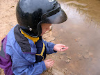 The scenery along the South Fork of Coal Wash is a bit different from the North Fork. The canyon bottom is wider and there are more springs along the South Fork. I saw some interesting features there, including a large alcove that beckoned for exploration, but they were too far away from the ATV trail for me to visit them on this trip. We only made a couple of short stops in the canyon, one of which was at a spring where Bradley played with the tadpoles in a shallow pool right at the edge of the trail. The ride through that part of Coal Wash seemed short, which it really was–compared to the North Fork, it’s much easier and faster riding. We soon found ourselves at the beginning of the Eva Conover Road.
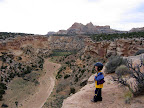 At about this point, it started sprinkling on-and-off, which continued throughout most of the day. I expected the Eva Conover Road to have a steeper climb out of Coal Wash, but it was pretty easy-going. The trail was very scenic, and followed the rim of a minor fork off of Coal Wash for the first little while. Bradley and I found our first geocache of the day along that section of trail. The next geocache that we found was about two miles farther along the trail on Secret Mesa, and there we saw two guys on dirt bikes who were the first people we’d seen after a full three hours of riding. When we finished up at the cache, it was nearing time for lunch, so we rode on while looking for a nice and sheltered spot at which to eat. We came to the end of the Eva Conover Road without having found a lunch spot, and just kept going past the UDOT shed (where they keep the snow plows for the nearby stretch of I-70) toward Eagle Canyon, but we found a very nice place to stop before reaching the trail leading down into Eagle Canyon.
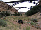 During our lunch stop it became a bit more windy and began sprinkling more heavily, so we donned our jackets for the first time. Bradley was cold enough that I put him in front of me on the ATV where he could take advantage of the heat from the engine. Luckily, as we descended into Eagle Canyon, the high canyon walls blocked much of the wind and it was much more comfortable for us both. When we got to the bottom of the Canyon we saw a couple more people, one person in a UTV and another guy (wearing shorts and a t-shirt!) on an ATV. We found three more geocaches in the canyon, and I really enjoyed the change of scenery. We weren’t far from the highest point in the Swell, and we’d gained over 1,000 feet of elevation from where we’d started the ride. Plant life changed from small scrub and pinyon/juniper to more grasses and various pine trees. We passed under the bridges of I-70, which were very impressive when viewed from underneath (they’re rather unremarkable when driving the interstate), and saw the huge natural arch in Eagle Canyon. While finding the geocache near the arch, a group of about eight ATVs passed us by going in the opposite direction.
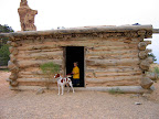 After less than four miles in the bottom of the canyon, the trail climbed out toward Swasey’s Cabin and the Head of Sinbad. There were even more pine trees as the trail climbed higher, topping out at about 7,200′ in elevation, and the scenery there was unlike any other part of the Swell. I stopped to talk to a couple on ATVs right before reaching the top of the trail near the cabin, and they remarked how comfortable Torrey looked riding in her basket on the front of my machine. When we reached the cabin, there were four motorcycles parked there but no people in sight. Bradley and I checked out the cabin, and just as we were about to leave, the motorcycle riders appeared along the nearby hiking trail and we stopped to chat for a while. They were from California and were on their first trip to Utah, and they also made a comment about Torrey and her comfy spot on the four-wheeler.
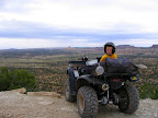 After the cabin, we made a short stop at some rock art close by, then crossed under I-70 through a concrete tunnel where we saw the last people (a couple on one ATV) that we’d see on the trail for the rest of the day. We made more very quick stops at Dutchman Arch and the Locomotive Point rock art. We crossed over Reid Neilson Draw started the descent down to Cane Wash. The first part of the trail was ugly–very rocky and pretty steep, and it was the first part that made me glad I was doing the loop counter-clockwise so I didn’t have to go up the hill. It eventually leveled out more and the descent slowed, and we found another geocache at a gorgeous overlook of Horseshoe Bend. From there, I could see the Wickiup and a huge chunk of the Swell and beyond.
It was nearing 5:00 PM when we left that cache, and for the first time during the ride the sun shone from behind the clouds. I had been wishing for sunshine during the day, mostly so my photos would turn out better, but it was short-lived. We reached Cane Wash and stopped briefly to let Bradley and Torrey play around and try to catch lizards, then started up the trail that leads over Fix-It Pass to the North Fork of Coal Wash. Shortly after leaving Cane Wash, some much darker clouds moved in and it began sprinkling again–it was time to put our jackets back on.
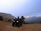 I stopped to take some photos at the top of the steep but short trail that leads down into the North Fork of Coal Wash, and that was the last time I took out my camera for a while. It started raining lightly, though still harder than anything we’d experienced so far, and it was almost 6:30 PM and already later than I’d expected us to be out. Going down that section of trail was really tough–by far the hardest thing I had done all day–and I was extremely glad that I wasn’t going up it instead. I made it to the bottom after making Bradley get off the ATV while I negotiated some bouldery drop-offs, then I let Torrey run alongside for about a half a mile just to keep her happy. The rain gradually got heavier, though still not too bad, but I decided I needed to pick up the pace and so started riding about as fast as I dared in order to get home at a decent time.
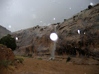 Shortly after passing up the Devil’s Racetrack turnoff, the rain started dumping buckets. We were still about an hours’ ride from where the truck was parked, and there was no escaping the rain. A few minutes later, waterfalls began pouring off the canyon walls. It was then that I realized we could be in serious trouble. I stopped just long enough to grab my camera and cell phone and put them in my backpack where they’d stay dry (though not before snapping a quick photo of one of the waterfalls), then took off again at full speed. Although it was about 7:00 PM and it should have been plenty light enough to see, I had to remove my sunglasses in order to make out the trail in front of me, though they were prescription lenses and so left me still not seeing as well as I should have been able to.
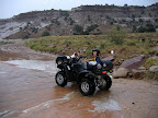 My ATV has never been ridden so hard and fast. I was seriously looking behind me on the straight stretches of trail expecting to see a flash flood rushing up behind us. Even a relatively small flow (not large enough to wash the ATV away) would have caused huge problems by obscuring obstacles in the trail and making egress difficult or impossible. There was some water already running in the bottom of the wash, which served to get us even more wet as the ATV splashed through it. After about five miles of hauling ass, we finally reached the junction where BLM road 6768 meets up with Coal Wash and we were able to exit the wash bottom. It was a huge relief to be away from flash flood danger, though we were now riding above the canyon rim and lightning was striking near enough to make me worry about getting struck. Fortunately, with the sandy and gravelly soil, mud wasn’t an issue…yet.
Bradley was miserable and kept asking how close to the truck we were, and Torrey was probably worse off than he was because she had no idea what was going on other than that she was cold and wet and bouncing around a lot. After what seemed like hours, but was actually about 50 minutes after the downpour started, we finally arrived at the truck. I pulled up right alongside the door, unlocked it, and picked Bradley up and set him down inside the truck, then did the same for Torrey. The road hadn’t been muddy up until that point, but the ground at the staging area was extremely sticky clay, as was the next mile of road leading back to civilization. In just the 40 or 50 feet I’d ridden across the staging area to get from the road to the truck, I’d gotten probably 50 pounds of mud stuck to the tires of the ATV. After getting Bradley squared away with a dry change of clothes (which I always carry for the kids), I circled the ATV around and drove up the ramp into the truck bed. I stayed in the truck bed while secured it with the ratcheting straps that I’d left in the truck bed, but I had to jump down to the ground to get the ramp unhooked, folded up, and tucked away under the ATV.
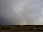 By that time I probably had several more pounds apiece of mud on my shoes, and after getting into the truck I spent a few minutes getting the mud off. By the time I was ready to drive away, I realized that I had forgotten to turn the hubs in, so I had to get back out and lock them in, then knock and scrape the mud off my shoes again. I’ve had an experience driving on this road in the mud once before and it wasn’t pretty, and I knew what to expect for the first mile of the drive back home. Despite being in 4WD and having better tires than the last time I was in this situation, at several times I was traveling with the truck at a 45-degree angle to the road but still making forward progress. There’s a ditch along the road that gets deep enough to swallow a vehicle in some places, and I almost slid into it a few times. It took me about 20 minutes to travel that one mile of bad road, though during dry conditions it’s easily possible to do between 30 and 60 miles per hour on it. After the greasy stretch, the road becomes gravel, then alternates between native surface (that’s not so clay-like) and gravel for the rest of the drive to Ferron, and I didn’t have any more problems with mud. I stopped just north of Ferron at a pull-out on Highway 10 so that we could eat some dinner which consisted of ham, cheese, crackers, and Fig Newtons. We got home well after 10:00 PM, and all I had the energy to do was to take a shower and go to bed.
I spent about two hours of my Father’s Day today cleaning the mud off the truck and ATV (and then the driveway). I would still want to do this ride again sometime, though it would be nice to have more daylight and nicer weather for the ride. With today being the summer solstice, I don’t believe the former is possible. 🙂 I would definitely only do this loop in a counter-clockwise direction. Some of the hills would be difficult to go up, and considering the amount of time the ride takes, difficulties should be minimized.
Coal Wash Loop Photo Gallery
Coal Wash Loop .KML File (for Google Earth)
Coal Wash Loop .KML File (in Google Maps)