Before going on this long camping trip on Skyline Drive I didn’t plan any particular hikes for the weekends, so before Friday I began looking for something to do since I had that day off work. Wait–first let me tell a little (or maybe too much) backstory. Astute readers have probably noticed that I’ve started hiking not only more often lately, but also for longer distances. This all goes back to a decision I made in September 2024, when I decided to get out of the rut I was in and start hiking more. It goes a lot deeper than that, though. I weighed just over 250 pounds and had been drinking too much for most of my adult life. In mid-November I decided to stop drinking completely, forever. In late December I didn’t feel like I was in better shape, and hiking more frequently didn’t seem to help much, so I started working out on the treadmill daily. Even that didn’t help significantly with weight loss–I think I had replaced alcohol with food–so at the end of January this year I completely changed my diet. And the pounds really started to drop. Before all these life changes I had difficulty hiking more than about five miles without joint pain, but as I lost weight (over 75 pounds at this point) my hikes got longer and longer to the point where I decided I actually wanted to do the longest hike I’ve ever done. Which is how I ended up hiking the Fish Creek National Recreation Trail on the 4th of July.
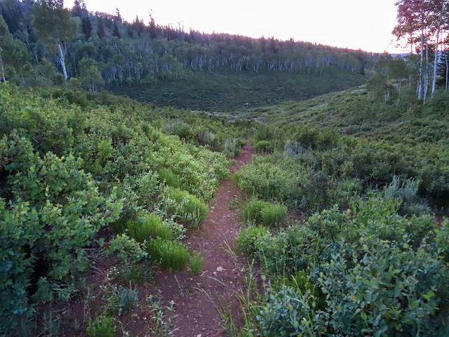
The trailhead was only seven miles from where I was camped and I got an early start, hitting the trail by headlamp at about 5:30 AM. I had ridden my mountain bike a couple miles up this trail from the bottom 15 years ago, and to get the desired length out of this hike I opted to hike down to where I’d left off that trip. The first bit of the trail travels through some trees until it reaches Straight Fork, where it crosses the creek on a bridge and goes another 1.5 miles before reaching Fish Creek proper. I was wearing waterproof gaiters and waterproof shoes but they were still getting soaked from dew on the overgrowth along the trail. The water wicked down into my socks all the way to my toes.
Leaving the trailhead around 5:30 AM

Trail through some aspen

Bridge over Straight Fork

Beaver ponds

Larkspur along the trail


A stand of elkweed

Very wet gaiters


A bit of Indian paintbrush

Fish Creek crossing

I hopped on some stones to cross Fish Creek, after which point the trail remains on the same side of the creek until it reaches a bridge at the lower trailhead (despite the USGS topo map showing several creek crossings). There was a good-sized herd of elk near the creek but they all ran once they noticed me. I briefly emerged into some direct sunlight and I really wanted to sit down and dry out but there was nowhere to take a seat.


Elk herd


Mouth of C Canyon


Stupid little bridge

Beaver pond reflection

Beaver pond reflection

Possible bear scat

Finally, after nearly four hours of hiking, the sun was high enough to hit the canyon bottom and I found a boulder to sit down on. I took off my gaiters and shoes and socks and let everything dry out (at least as much as it could) for almost an hour. Even that long wasn’t enough to dry everything out so I resigned myself to hiking in wet shoes the rest of the day. I pressed on down the trail and reached a point where some recent trail work had been done. Six hours after starting the hike I had reached my turnaround point where I’d left off on the mountain bike ride all those years ago.
Drying out in the sun

Beaver dam

Mouth of Gooseberry Creek

Recent trail work

View downstream at my turnaround point

View upstream at my turnaround point

I reversed course and hiked back up the trail and shortly thereafter found a spot to sit down for a quick lunch break. Then I hit the trail again and just kept moving. At one point I saw some movement near the creek and peered down to see a badger digging at the steep bank, where it pulled out a rodent and started gnawing on it. I watched for a while before the badger noticed me–it just froze and stared at me for a few seconds, then ran away, leaving its meal there on the ground. I was a little hot so I dipped my hat in the creek before placing it back on my head and continuing. I reached the trailhead after hiking almost 12 hours and covering 16.5 miles.
Beaver dams

Beaver dam


Badger


16.5 miles on the odometer

Up until now the longest hike I’ve ever done was near Spring Canyon Arch, which was 15.6 miles (my GPS read 14.9 at the time but after correcting a gap in the track it was a bit longer). That hike and several others similar in length (and even some much shorter) were really hard on me and I was always sore for days afterward. This time, however, I felt great at the end and easily had five or more miles in me, with no soreness in the days that followed. Stopping drinking and losing weight made a lot of small health problems (and a couple of bigger ones) just go away. And now, in the short term, I’m focusing on finishing my last five remaining Utah county high points, with the ultimate goal of standing on King’s Peak on my 50th birthday next year.
Photo Gallery: Fish Creek National Recreation Trail
Congratulations!