 Since I didn’t get to explore as much of Gentry Mountain as I’d hoped to last week, I returned this past weekend and explored the rest of it. Traci and the kids were at her family reunion at the campground near the power plant in Huntington Canyon, and as it just so happened I had planned on hiking to the south end of Wild Horse Ridge, which overlooks the campground from a height of 2,600′. I got up early (for a Saturday) and left home by 8:00. There were dark clouds all around and I could see rain falling to the south, but there were patches of blue skies to the west. At the Mohrland Road turnoff, there were sheriff’s deputies directing traffic due to a triathlon. The biking portion of the triathlon followed the lower seven miles of Mohrland Road, and one deputy tried to talk me into going a different way, but he eventually let me pass and just asked me to be very careful. I only saw a handful of bikers on the road, and I gave them a wide berth. I got to the old townsite of Mohrland just before 9:00 AM and unloaded the ATV. The skies had cleared up and the weather was looking better.
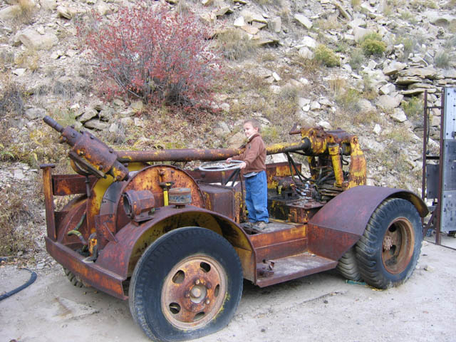
 The road leading up onto Gentry Mountain was graded gravel and in very good condition. It had obviously been widened and improved since the last time I was there in 2005, when it was a narrower dirt road. I took my time riding up the road, stopping to look at the old mining ruins. I was sad to see that some reclamation had been done, and this machinery was no longer there. As I continued up the road past the Mohrland mine, the road was about as steep as the Wattis road that we’d ridden up the previous weekend, but since it was wider and graveled, it was much less worrisome.
 When the road reached the top of the mountain, I continued riding west and crossed into the Manti-La Sal National Forest and headed toward Wild Horse Point. We called off our hike the weekend before because of a gate with a “No Trespassing” sign on the way to Wild Horse Point, but after thinking about it all last week, I decided not to worry about it. The road only crossed private property for 0.2 miles after the gate, and beyond that the parking area and entire hike were on national forest lands. I parked at Wild Horse Point and started the hike down Wild Horse Ridge. The first part descended a very steep and loose hillside, and near the bottom of the hill was a small pond. The pond didn’t have any water visibly flowing into it, but it had a pretty good outflow rate, so it must be fed by an underground spring. After passing the pond and hiking through some thick trees, I came out in a clearing and began following the top of Wild Horse Ridge south.
 From that point on, I kept to the top of the ridge, following it up and down over several hills and saddles. Along the way I saw a pile of sandstone drill cores where somebody has obviously drilled a deep hole. There was a rusty metal pipe in the ground nearby, and I assume that was the drill hole. I can only imagine that the drill hole had something to do with the coal mine in Bear Creek Canyon, as I’m sure their coal seam runs several hundred or even a few thousand feet below. Beyond the drill cores, there wasn’t much else of interest to see during the hike to the end of Wild Horse Ridge except for a few interesting views down into Huntington Canyon. As I approached the small peak at the end of the ridge, I saw some very strange concretions in the rock. Just beyond the high point of the peak, I reached a cliff that couldn’t be downclimbed, so I backtracked just a bit until I found a way to climb down, then skirted around the bottom of the cliff in order to get farther out on the point. From there, I had a good view into Huntington Canyon. I could see the power plant and the campground where Traci was. I placed a geocache there, and as I was averaging the coordinates in my GPS, it began to rain lightly. It actually felt good after the hike. After finishing up the cache placement, I reverse course and returned to my ATV. When I got back to the pile of drill cores, I picked up a couple of them to take home as souvenirs. Torrey took a dip in the pond just before the steep scramble back to the 4-wheeler, and there I noticed some lovely-smelling wild roses that I hadn’t seen earlier.
 Back at the ATV, I was a little exhausted from the hike and didn’t feel like eating lunch quite yet, so I just got on and rode. I didn’t get to ride out to McCadden Ridge last time, so that’s where I headed. Along the way I found a nice spot under a pine tree to eat lunch, which consisted of a bean salad I’d made the night before and some Powerade. After that I continued to the end of the road on McCadden Ridge, and the view there was…not spectacular. I snapped a photo or two, then headed to the north end of Gentry Mountain. Along the way, I tried getting to the southwestern corner of Carbon County, but both roads visible in Google Earth have been closed by the Forest Service, and I wasn’t feeling up to another hike, however short it might have been (less than a mile).
 I continued north and checked out a road that passed though an area called Little Park and ended at a place called the Steeps. Near Little Park were two drill holes spaced very close together, which is something I’ve never seen before. Where the road officially ended, an ATV trail continued up the hill toward Castle Valley Ridge. It didn’t appear in Google Earth that the trail went very far past the top of the hill, but I still wanted to check it out. If the road did happen to continue all the way along Castle Valley Ridge to Nuck Woodard Canyon (or Nuck Woodward, depending on which map you look at), it could make for an awesome ride. Unfortunately, as I climbed the hill, it suddenly seemed much steeper than it had looked from the bottom. It felt a lot like the time when I rolled my ATV, except without the snow. It still scared the shit out of me. I came to a stop, shifted out of 4WD, and used mostly the front brakes while backing down the hill. The front brakes kept locking up as I slid backward down the hill, so I very gently applied the rear brakes just enough to slow my descent without sending me over backward. I made it to the bottom and breathed a sigh of relief.
 The last place I visited after that was the end of the road on Wild Cattle Ridge. It was much like McCadden Ridge–nothing special, not much of a view. From there, I simply cruised back to the truck without making any more stops. I’d hoped to have enough time left in the day to go visit Traci for a bit at her family reunion, but I was beat and it was close enough to dinner time that I just headed home. I’ve now ridden my ATV over the entirety of every legal road on Gentry Mountain, and even a couple that aren’t on the official travel plan. It’s a nice place to go to escape the heat of the valley during the summer, but having seen most of it, I probably won’t be back for a while.
Photo Gallery
GPS Tracklog and Photo Locations (Google Earth .KMZ File)