I am really beginning to get to know the Coal Wash area, and I’m really liking that place. I first rode Coal Wash on my ATV in December, when I did the lower part of the canyon and the north fork, then took the Devil’s Racetrack trail. Again in January I rode the north fork, just before crashing my ATV in Eagle Canyon. While we were camped near Horn Silver Gulch a few weeks ago, Traci and I rode along the lower end of Coal Wash. I never really stopped to explore off the trail any of those times, but on Sunday and again yesterday, I did just that.
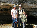
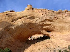
 Last week I was chatting with Cortney, and he asked if we wanted to ride Coal Wash with his family to see the sights mentioned in Mark Williams’ book, Utah’s Scenic San Rafael. I managed to talk Traci into going on Mother’s Day, so that morning we met up with the Hunt family at around 10:00 a.m. at the staging area near Horn Silver Gulch. We made many stops, including The Drips (a natural spring that flows out of an overhanging cliff), a large sand dune for the kids to play on, some rock art, natural arches, and an old copper mine. We rode as far as Slipper Arch, where we ate lunch and climbed around on the rocks under the arch. I hiked nearly all the way to the top of the arch, but turned back because we were short on time and still had a few stops left to make on the ride back. One of those stops was at the ZCMI mine, where a hundred years ago somebody had tried mining copper from the Navajo Sandstone. It doesn’t look as though they had much luck, because there are only two short prospect shafts in the hillside. We went, with our dim flashlights, all the way to the end of both shafts, then Cort and I placed a geocache nearby. I had spotted another natural arch in a cliff on the ride up Coal Wash, so on the ride back down we stopped briefly so I could check it out. I never did see through the arch–I could only see sunlight on the cliff below it that seemed to indicate that there was an arch. It was yet another hike that wasn’t on the itinerary and would have to wait until a different day.
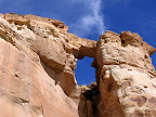
 That day came sooner than I expected, and yesterday I decided to work earlier in the day so I could spend the afternoon and evening riding Coal Wash again and doing some more exploring on foot. I got to the staging area at around 4:00 p.m. and rode straight through to the North Fork of Coal Wash without making any stops. About three miles into the north fork, I parked alongside the trail and hiked to what I was pretty sure would be a natural arch. After hiking away from the trail for a short distance, I was able to see the arch from a different angle and, sure enough, I could see the sky through a big hole in the top of the cliff. I placed a geocache nearby, then headed back to the trail and my next destination, Slipper Arch.
 I was pretty sure from Sunday’s hike that I could get on top of Slipper Arch, but I didn’t summit the plateau that time and couldn’t tell for certain. Yesterday, I hiked through the arch and then up the steep, rocky, and bouldery slope behind it and made it to the top of the plateau. From there, it was an easy and relatively level walk to the top of the arch, with only one small downclimb. I had planned on placing another geocache directly on top of the arch, but the downclimb could be tricky for some, and the dropoff on either side of the arch was huge, so I hike a few hundred feet southeast and found a good hiding spot for the cache.
It was about a quarter past 7:00 when I got back down to my ATV. I had poor cell reception there, so I sent Traci a text telling her that I was done with my hikes and would be back at the truck in one hour. I wasn’t sure that I could actually make it that fast, but I sure tried. I don’t think Torrey enjoyed the ride back, since she bounced around on the front of the ATV while I kept the throttle pinned for most of the ride. I made it to the truck in about 55 minutes, and the sun was already down by then.
With as many times as I’ve now been through Coal Wash, I still haven’t been over Fix-It Pass or through the South Fork of Coal Wash. Someday (perhaps not until after summer) I’ll do the ride through the North Fork of Coal Wash, over Fix-It Pass, across Cane Wash, around Locomotive Point, under I-70 to Swasey’s Cabin, down into Eagle Canyon and under I-70 again, then up onto Secret Mesa and down into the South Fork of Coal Wash, and back to the truck. That would be an epic 55-mile ride, probably without much time for stopping to enjoy the scenery, unless I camped overnight along the trail and made it a two-day trip. I’m sure that during that trip, I’ll see yet more places that will leave me wanting to come back to explore. A place like that could keep somebody busy for years just trying to get acquainted with it.
Coal Wash Photo Gallery
Coal Wash .KML File (for Google Earth)
Coal Wash .KML File (in Google Maps)
I need to go check out Coal Wash one these upcoming weekends. The Spanish Crosses look well worth seeing.