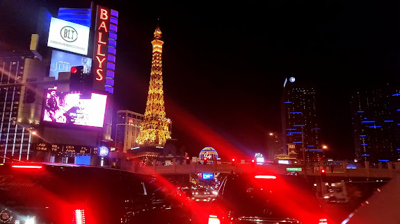
The Mojave Desert first caught my interest last year while driving to L.A. on a family vacation, but I never seriously expected to hang out there. Then, a couple of weeks ago, I began obsessing about the area after watching an episode of the YouTube series Roadkill in which they drove across the Mojave in southern Nevada in a lowrider (yeah, both silly and hilarious). I needed a break from the snow in Utah so I researched the area and found that Mojave National Preserve in California looked ideal for a road trip. At the last minute I pitched the idea to Chris. He had to shuffle some things around at work, but by Thursday afternoon he was able to commit to the trip, and on Friday afternoon before the long Martin Luther King, Jr. Day weekend we hit the road. The sun set before we reached I-15, but driving at night made for a good excuse to make a slight detour to the Las Vegas Strip since I’d never been there at night. We hit Baker, CA at about 10PM and loaded up on fuel and “supplies,” then drove southeast into Mojave National Preserve. I’d previously identified a camping spot using Google Earth, so we followed the GPS along dirt roads in the dark until we found camp.
An owl took up residence in the cliffs above our camp and its hoot woke me up a couple of times during the night, but I just smiled at the novelty of it and went back to sleep each time. I was eager to rise after the sun came up so I could see in the daylight where we’d landed. We were camped in Black Tank Wash, in the middle of an area called Cinder Cone Lava Beds. Before even fixing coffee and breakfast, Chris and I hiked around for quite a while exploring our new surroundings. After eating breakfast and packing up our gear, we drove a short while to look at a lava tube. The lava tube had a couple of skylights, but due to overcast skies we didn’t get to see the beam of sunlight that I was hoping for.
Our next stop was Kelso, which is a former railroad depot and mining town, and which is now a visitor center managed by the NPS, surrounded by abandoned buildings and infrastructure. After checking out the small museum at the visitor center we headed south and made the three-mile round-trip hike to the highest point in the Kelso Dunes. Up to this point we hadn’t encountered many people in the Preserve, but at the top of the dunes there were perhaps 30 other people. The hike up the dunes was a slow slog, but Chris and I ran down the steepest slope on the way down and made fun, quick work of the descent. After a simple lunch at the Kelso Dunes trailhead we drove farther south to the Granite Mountains and found a place to camp near Granite Pass. It was somewhat early in the day to set up camp, but we wanted to make up for arriving late the previous evening. Once we found a suitable camp spot we hiked around and explored the gorgeous granite hills and boulders on the east side of the Granite Mountains. Seriously, the area was simply beautiful. We turned in early that night and slept on the ground without tents.
Sunday was much less planned out than the previous days. Following a map that Chris had grabbed at the Kelso visitor center, we took a dirt road between Kelbaker Road and Essex Road. Along the way we encountered mining ruins near Hidden Hill and Bighorn Mine. We entered a mine shaft, explored mining ruins, and we both really enjoyed the restored cabin called Hilltop House. We returned to the pavement at Essex Road and went right at the fork onto Black Canyon Road, where we stopped a couple of times to visit Colton Well and some volcanic alcoves at the northern end of Fenner Valley that had obvious signs of Indian occupation.
At Hole-in-the-Wall we followed the Rings Trail through Banshee Canyon. At two dryfalls in the canyon there were steel rings embedded in the cliffs that provided hand- and footholds. Near Hole-in-the-Wall we spotted some petroglyphs, and a short distance away we sought to find more rock art at Counsel Rocks. My research played out well and we found the pictographs and petroglyphs that I’d hoped to find.
It was getting late and we hadn’t planned on a specific campsite that evening. We were on Cima Road and just started exploring dirt roads at random while looking for a good place to camp. There were some nice, scenic camp spots against granite outcroppings just west of Kessler Peak, but there was no cell service there (which was sort of important to both Chris and me, as we wanted to communicate with our significant others). After more wandering we found a decent campsite at White Rock Spring. This time I set up my tent while Chris slept on the ground sans tent. At sunup I awakened after a good night’s sleep and checked out our surroundings. There was a corral nearby made out of railroad ties–out of habit I checked the ties for date nails, and I even found a few dating from the early- to mid-1930s. It was a relatively short drive from our last night’s camp to I-15, and from there it was a pretty straightforward cruise home, with fuel stops in Vegas and Cedar City.
Despite being managed by the National Park Service, Mojave National Preserve was a nice place to visit. Restrictions were much fewer than in any national park–for example, dogs, primitive dispersed camping, and campfires are all allowed. Chris and I talked about perhaps visiting JOTR next January…we’ll see how that compares to MOJA.
Photo Gallery: Mojave National Preserve


