Traci spent all day yesterday doing Relay for Life, so instead of sticking around town and being bored, the boys and I went for a road trip. I’m not quite sure why I settled on the San Rafael Desert, but it’s been a while since I’ve been there, and I never really got a chance to explore the area the three previous time I’d been there. It wasn’t until Friday after work that I even decided on where to go, so I spent that evening getting everything prepared for a fun trip. I knew it would be a very long trip with a lot of driving (it was 260 miles total, with 100 miles being on gravel and dirt roads), so I found a few ways to keep Michael and Bradley interested and entertained along the way. I let them pick out their own lunches and dinners (mostly Lunchables, with a few snacks in between), and also planned out several short stops along the way to break up the monotony of the drive.
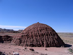 We left Price just after 8:00 am on Saturday morning, which was a little later than I’d hoped but still early enough to have a full day for exploring. Our first stop was for a quick potty break at the beginning of the gravel road just south of Green River, and several miles after that we stopped again at Horse Bench Reservoir so that the boys could climb around on the rocks and I could find a geocache. Our next stop was at a place where the road crossed a small sand dune. Michael and Bradley love playing in the sand (hell, so do I), and there’s no shortage of it in the San Rafael Desert. Short stops like this really kept them happy, which in turn made the trip worthwhile for me.
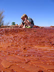 After the sand dune, we moved along to the Chaffin Ranch to see the geyser there (see DesertWoodrat’s blog post for more photos and a great video). When we arrived, the ground around the geyser was pretty wet, so I think it had erupted shortly before we got there. While we waited for the geyser to go off, the boys played around and collected rocks and sticks coated in travertine. I have a problem with them always bringing home rocks in their pockets (we have too many at home as it is), so I had to set some ground rules wherein they could only collect rocks on this trip when they had my approval, and I let them each take one piece of travertine from there. We waited around for just over 40 minutes with no eruption–all we got was to hear some air escaping early on, though it was silent when we left. Michael and Bradley were disappointed because I told them they could play in the water if it erupted while we were there, but they also understood that the longer we spent waiting, the less we would be able to do later in the day.
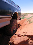 The next stretch of driving was pretty long, but the boys were satisfied so far with everything we’d done, so it wasn’t too boring for them. We kept going south on the main road after crossing the San Rafael River bridge and took the turnoff to Saucer Basin. The basin was surprisingly green, much more so than I remember when I was there four years ago. The road was washed out slightly where it crossed upper Moonshine Wash (or lower North Spring Wash, I’m not sure which), and I tried to power through the sandy edges of the washout in 2WD but got stuck. Locking in the hubs solved that problem quickly and we were soon on our way again. My destination at the end of this road was the Cone, a formation at the west end of Gruver’s Mesa. I’d seen the Cone many times in satellite photos, and had even seen it in person from quite a distance. The topography has always amazed me–the sandstone is heavily pock-marked, with some of the circles/craters being bigger than 200 feet in diameter. I’ve long wanted to see it in person and up-close.

The road atop Gruver’s Mesa crosses an old landing strip that has mostly grown over with brush. In the satellite photos, it looked like the road ended at the west end of the mesa, but I wasn’t able to drive that close. There was a narrow ridge that the road crossed about 0.15 miles from the end, but it had washed out a bit and I didn’t dare drive across it. We parked just before the washout and ate lunch since it was nearly 1:00 pm, then filled up our water bottles and set out on foot. I didn’t want to push the boys too hard, so I told them that we could stop hiking and head back to the truck anytime they wanted, and I half expected them to see the route down to the Cone and want to turn back right then. I was very surprised when both of them saw what we had to hike down, and they both still wanted to go there, even after I reminded them that we would have to hike back up the ridge we were about to hike down. I expected it to be difficult finding a route down to the Cone, but the “road” actually continued down most of the way, apparently a remnant of mineral/oil exploration from many decades ago. We had to pick our way down a series of ledges near the bottom of the mesa, but it wasn’t anything that a five-year-old couldn’t handle.
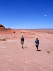 Upon reaching the bottom of the Cone, I decided that climbing to the top wouldn’t be appropriate for Michael and Bradley, so I convinced them to hike all the way around it instead (the summit will have to wait for another day). About the time we had gone halfway around the Cone, they decided that they’d had enough hiking and wanted to go back to the truck. Since we were already halfway around, they were amenable to continuing the rest of the way around, although the terrain was a bit rougher ahead of us. We made it without any troubles though, and I decided to place a geocache at the base of the Cone before we continued on our way. Very shortly after we started heading back, we found chert arrowhead chippings scattered over a huge area, and each of the boys picked up a piece to take home. The hike back to the top of Gruver’s Mesa went smoothly. Just before the last steep hill before the very top, I stopped to pick up a piece of petrified wood that I’d spotted on the way down. It weighed about 50 pounds, and it was no easy feat getting it to the top. Even after that, carrying it on level ground was difficult, but I made it the entire 1,000 feet back to the truck without breaking my back. 🙂
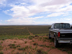 By the time we got back on the road, we’d been gone from home for about eight hours and most of the day was gone. I had to skip a few planned stops in order to make it home at a decent time, but we still had time to squeeze in the huge sand dunes near Middle Canyon and the igneous dike near the Big Flat Tops. There was quite a bit of driving between Gruver’s Mesa and the sand dunes, but the kids were beat from the hike and both of them fell asleep along the way. I made a brief stop at Lookout Point, and as I pulled up I startled a golden eagle that was just sitting on the ground there. I was about 30 feet from the eagle before I even realized it was there, and it noticed me at about the same time and took flight. I was too slow in grabbing the camera to get a decent photo, but I spent a minute or two enjoying the view, then moved on.
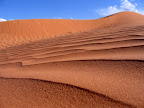 When we got to the sand dunes, the kids had awakened and were ready to play again. I had expected to spend a lot of time there, but the wind was blowing a lot of sand and soon irritated the kids to the point where they were ready to stop playing and eat dinner. I had them strip off their shoes and clothes and cleaned the sand out of everything (and there was a lot), then we drove a short distance down the road and found a nice spot to park and eat dinner. I really hated having to drive past the Sweetwater Reef turnoff, but I knew that the area was too big to explore with as little time as we had left, so we pressed on toward the igneous dike. There are three large sections where the dike is exposed, but I chose to stop at the the largest section on this trip since we were short on time (I’ll be back for the rest some other day). We had to hike about a quarter-mile from the nearest road to the dike. We climbed around on it, and I took a ton of photos. I’ve seen a couple of igneous dikes (there aren’t a lot in this part of Utah), and this one is the most interesting. I placed a geocache there, the kids each picked up a piece of volcanic rock, then we headed back to the truck. I gave the kids some snacks for the drive home, then we were on our way toward UT-24. We had to pass up Little Flat Top, which was another place I had wanted to stop. The full moon appeared in the sky before we got back to the highway, and I caught glimpses of it in my rearview mirror all along the drive home.
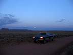 We got home at 10:20 pm, just in time to take a quick shower and crash in our beds. I was hoping that my sunburn would wash off, but only some of that redness was from the red dirt and sand in the desert. The backs of my legs got burned pretty badly, but the kids fared better because they’ve spent more time out in the sun than I have this summer. I took 400 photos on the trip, and I’ve whittled them down to 77 that were worthy of being posted online, which you can view here.
I’ve spent a lot of today contemplating my next trip to the area, but I’m not sure I’ll make it back there during the heat of summer. Spring seems to have passed me by, and I sure didn’t get out quite enough when the weather was moderate. I’ll have to make the best of this fall.