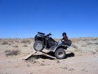
I spent all day yesterday with my family in the Swell, and we thoroughly enjoyed the beautiful weather we’ve been having lately. We were gone from home for 12 hours–less than two hours of that was drive time, and the rest was riding ATVs and hiking. We covered 50 miles and stopped at several places of interest, and we were all sore and sunburned when we got home.
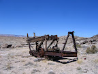
 We parked the truck at a staging area within sight of King’s Crown. It was a little before 10:00 am, and it was still a bit chilly. We only wore sweatshirts with windbreakers over them, and we had to keep our speeds down for the first part of the ride in order to not freeze. We rode the ATVs for a couple of miles on the main road until we came to our first turnoff, and the next road followed the edge of some Morrison Formation badlands. We connected with several other roads as we headed roughly northeast, and eventually came to our first stop near the head of the San Rafael River. The river begins when Ferron, Cottonwood, and Huntington creeks all converge within a quarter-mile of each other. The road doesn’t go down to the river, but instead ends at an overlook that drops steeply down to the river bottom. I had hoped to find a nice spot there to eat lunch, but it was pretty barren and wide-open, so we opted to turn around and find the road to our next stop which was an old piece of mining or drilling equipment. We enjoyed our lunch there, and I examined the old machinery and tried (unsuccessfully) to figure out what it was used for. I also hiked around a bit and found a couple of old mining claims in glass jars. I’m not sure what they were prospecting for (uranium?), but apparently they didn’t find it.
 The next place we visited was a trail across Sand Bench that dead-ends atop a cliff above the Red Ledges. I couldn’t see much of the trail in Google Earth, so when planning out our route on Friday evening I just used the USGS topo maps in ExpertGPS to mark waypoints along the dashed line that represented the road. However, even being there in person, the trail is impossible to make out on the ground. The beginning of the trail is signed with a Carsonite sign, but after a hundred feet or so, it completely disappears. We ended up traveling cross-country, picking the best route to the next waypoint in my GPS, but the waypoints were spaced about four-tenths of a mile apart, so that required a lot of route-finding. Along the way, we saw some interesting Curtis Formation rocks that the kids wanted to climb around on, so Traci and I dropped them off at the rocks while we kept riding and trying to find the trail. The kids hiked along the top of a ridge of rocks that paralelled our course and eventually we met back up in the bottom of Red Wash. From there, the trail was partially visible for a short distance where it climbed a sandy hill out of the wash. About halfway to the end of the trail, there was another Carsonite marker, but the trail was completely obscured and overgrown at that point. We ended up traveling the remaining distance in as straight a line as we could manage while trying to avoid large clumps of cactus and large brush. The view from the overlook was great, though typical of such overlooks that exist all along Sand Bench for the 40 or so miles that it stretches across the San Rafael Swell.
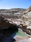
 After bumping back down the now well-traveled (hah!) “trail,” we rode north again and parked the ATVs where the road ended at Red Wash. We hiked down the wash until we reached a large spring-fed pool of water that I’d been to before while finding a nearby geocache (Herder’s Game – GC11E7T). My reason for returning is that there’s an 1863 carving in the rock nearby that I didn’t see the last time I was there, and I wanted to see it and photograph it. The hike there was fun, and the pool of water was more interesting than I remembered. If I’d had the time, I would have found a route down to the pool, but we had more places to see and it was getting later in the day.
From the dead-end where we were parked near Red Wash, the road leads south all the way to the main road, and we followed it there uneventfully and with no more stops. Upon reaching the main graded dirt road, we started looking for places to camp for a future trip to the area. We also took a short road heading south from the main road (so far, all of our riding had been to the north) along Sand Bench so that we could find a secluded spot to eat dinner and for the kids to play on the rocks some more. After eating, we made good time along the main road back to the truck, and the sun had set by the time we got there. It was pretty cold by the time I finished loading and securing the ATVs, and I was grateful to jump in the truck and crank up the heater for the drive home.
I could do that trip all over again and still have fun. There wasn’t a place that we stopped that isn’t worth going to again, and I think someday I’ll do it. I would like to explore the area around the head of the San Rafael River on foot, and there are some sections of Red Wash where it cuts through Sand Bench that I would like to hike through as well. There’s one place we had intended to look at but didn’t have time to, about 1.5 miles south of where we ate dinner. Judging from the aerial imagery in Google Earth, that area is similar to Ghoul Gulch, but it involves a short (less than half a mile) hike to get there, and is probably better suited for a half-day exploration. I also found out just today that there are some amazing pictographs about a quarter-mile from there, so I suppose it’s a good thing I didn’t make it there yesterday. It will be nicer to spend some time there when I’m not in a rush.