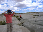
 My wife went up north for two days to scrapbook with her fam, so I asked the boys what they wanted to do today while she was gone. They unanimously agreed that they wanted to go to Hamburger Rocks in the northwestern Swell. I’ve been pretty much everywhere in that area, but I spent some time this morning looking in Google Earth and found a few roads that I hadn’t been down before. We started off by going to Fuller Bottom, and I stopped at the river crossing to let the kids play near the river and skip some stones. I took a road leading west-northwest from near there that leads to the base of the Red Ledges near Cat Canyon. There was a steep hill with a series of ledges that I didn’t want to try driving up, so I turned around about 0.4 miles short of where I’d intended to go.
From there I headed back up to Buckhorn Flat and then down the Hambrick road. We stopped at Hamburger Rocks and ate lunch, then Michael and Bradley played on the rocks for a long time. After that I drove a short distance northeast and took a road that I’d seen before and always wondered about. It heads southeast in a perfectly straight line for 1.3 miles across Sand Bench until it reaches an overlook at the top of the Red Ledges. I stopped at the overlook for a bit, and even found a steep talus slope that allowed us to scramble halfway down the Entrada Sandstone cliffs. When I got back on the road again there were some ominous clouds off to the west, and it was clearly raining in Castle Dale about 10 miles away. I stepped on the gas and hurriedly followed the road as it skirted the eastern rim of Sand Bench, and as I drove north I realized that the storm was also moving mostly north. It never moved very far over the Swell, so we got sprinkled on a few times but the roads stayed dry.
The Sand Bench rim road eventually spit me out onto the Green River Cutoff Road near Red Knoll, and in order to get to the next road that I wanted to check out I had to circle back around to the Hambrick road again. This time I turned off to the west of the Hambrick road and followed a couple of two-track roads in the Favorite Hills. One of the roads dead-ended at a fascinating area covered by exhumed river channels in the Morrison Formation rocks. Another fork of the road almost connected me with another road that follows Red Seep Wash that I’d driven on a few months ago, but I got stopped by a rough spot in the road a mere 800′ from where I’d been before. I was bummed about that because I didn’t want to drive back the way I’d just come. It was getting late by then, and I parked the truck and let the kids play and eat a snack before we started the drive home.
I had a good time, though it would have been better with some adult company. Both of the roads in the Favorite Hills and the road that follows the rim of Sand Bench were fun 4WD roads, and there were a lot of areas just off the roads that would be good to explore on foot. I wasn’t up for any hiking today, but I’m filing these areas away in my head for future reference.
Looks like fun, I wish I lived that close to the desert.