
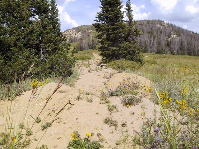
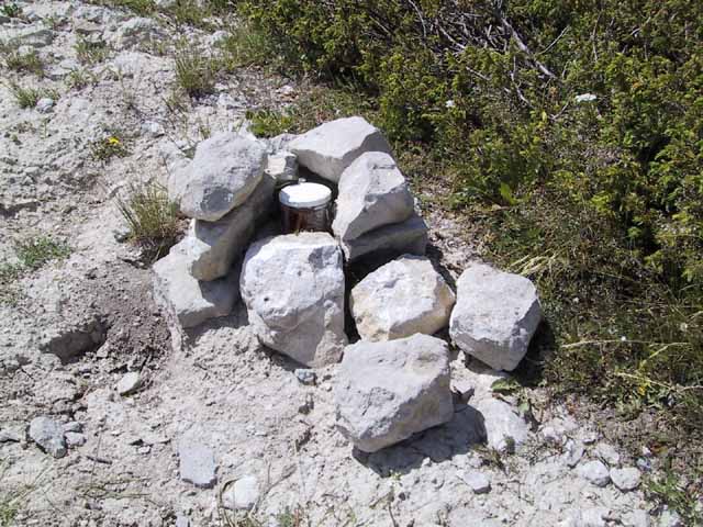
The hike to South Tent Mountain yesterday was just so-so, but by the time I got home afterwards I had a nasty migraine and ended up staying in bed the rest of the evening. It took me more than 2½ hours to drive from home to the trailhead. I’d forgotten how bad that stretch of Skyline Drive is–I hadn’t driven it since I had my Subaru out there more than two years ago. I parked at the trailhead around 10:00 am, but the road/trail that was supposed to lead to the top of North Tent Mountain has been torn up by the Forest Service. I hiked along the side of the demolished trail until it started switching back and forth, then I headed straight for the north (and tallest) peak of North Tent Mountain. After resting there, I hiked down the small saddle to the south peak of North Tent Mountain, where there was a cairn and a register in a glass jar. I signed the register, then started down the big saddle on the way to South Tent Mountain. By that time I was already pretty exhausted, so the hike up South Tent took me a long time, with a lot of rest stops. I reached the top at 1:00 pm, then took another long rest before moving on. Instead of tracing my route back to the trailhead, I hiked straight down the side of the mountain and met up with a trail that took me back to the car.
Overall, the hike took me 4 hours and 45 minutes, though the book I was following listed the difficulty as easy and the time on the trail as 2.5 hours maximum. I hope it was the altitude that did me in (over 11,000 feet), because I’m pretty sure I could hike four miles in much less time at a lower elevation. Either way, I need to get out more and either hike more often or exercise regularly between hikes.
The drive home was pretty interesting, since I didn’t take the same road as I’d come in on. When I got back to the car after the hike, there were some dark clouds moving in from the north, and I didn’t dare chance driving that direction for 20 miles on a steep dirt road. If it had started raining, I would have been stuck there until the roads dried out, or else risk sliding hundreds of feet down the mountain to my death. So, I started driving south on Skyline Drive, not knowing exactly where the road would come out. I decided to follow the signs and head for the nearest paved road, no matter which side of the Wasatch mountains I ended up on. After just a few miles, the condition of the road improved a great deal, with crushed gravel instead of rocks and ruts. A few miles after that, I reached a junction and a sign that pointed to Orangeville. The road eventually came out in Joe’s Valley, and on the way back home on SR-10, I noticed that those dark clouds were dumping rain on the mountains near north Skyline Drive. It was also just starting to rain in Huntington when I passed through, turning the thick coat of dust on the Mazda into mud–it needs to be washed pretty badly now.
Before yesterday, I’d planned on hiking to Fish Lake Hightop next, but with a “moderate” difficulty listing and an 8½ mile hike, I think I’ll pass for now. East Mountain in Emery County sounds a little better–while also having moderate difficulty, it’s only a two mile hike, and it’s much closer to home.