The first time I saw the terrain near Box Flat, I was instantly intrigued and wanted to explore it. The road to there is pretty rough and difficult to follow, and even if you get as far as Box Flat, any further exploration has to be done on foot because it’s part of the Mexican Mountain Wilderness Study Area. I first saw the area from a few miles away when I was finding a geocache (Double Shot Espresso) more than two years ago, and since then I’ve admired it from an even greater distance on a few occasions–see this photo taken from about eight miles northwest, and this one from eight miles to the northeast. My interest was rekindled recently when somebody e-mailed me about some of my photos of Cottonwood Wash that she had seen online. My photos were of a different Cottonwood Wash (there are about 25 such named washes/canyons in Utah), but we e-mailed each other back and forth a few times about the area between Cottonwood Wash and Box Flat, and she even sent me some of her photos from a trip through there on horseback. Seeing those photos was enough to finally get me out there to see the area up close.
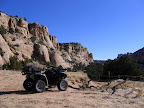
I almost didn’t go there this weekend because there was a 60-70% chance of rain/snow on Saturday. However, when I woke up yesterday morning I could see blue sky in all directions, with only moderate cloud cover, so I started the routine of getting myself and my ATV ready for a trip. By the time I was ready to leave town, the weather had deteriorated and some dark clouds were moving in from the west and dumping snow on the mountains. Since I was already loaded up and ready to go, I decided to risk it and hope for the best. By the time I reached Buckhorn Flat, it looked like I was outrunning the weather, and it was beautiful and sunny there. The rain and snow never got farther east than Castle Valley and I had wonderful conditions all day long.
 I parked the truck near Dry Pond on Big Flat and unloaded the ATV, then rode southwest into the Prickly Pear Flat area. I checked out what I presume to be an old cowboy camp that I’d read about in DesertWoodrat’s ride report. I was shocked to see that there had recently been a trackhoe there that had dug a huge hole and built up an earthen dam, and also destroyed several trees. I also saw its tracks heading cross-country off to the south (in a Wilderness Study Area!). Surely that kind of work would either have to be done by the BLM, or at least have BLM approval, so it was surprising to see so much damage done in a WSA.
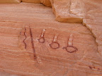
 After the cowboy camp, I kept going southwest and parked at the top of the cliffs about half a mile northwest of the rock art panel. I hiked to the rock art and took some photos, then hiked a short distance south from there to a little tree-covered knoll to look for arrowheads. If I was shocked earlier to see heavy equipment tracks near the cowboy camp, I was absolutely flabbergasted to see them near the rock art panel! I ran across more tracks about 600 feet southwest of the rock art, and they appeared to be heading south, perhaps to the “ponderosa cove” area.
On my way back to my ATV (shaking my head the entire way while envisioning a trackhoe driving around the Swell), I realized that the ATV key wasn’t in my pocket. I didn’t specifically remember either taking the key with me or leaving it in the ignition, and it sent me into a panic. Since I was already halfway back to where I’d parked it, I decided to cover the remaining distance and hoped that the key would be there. Thankfully it was still in the ignition, otherwise I would’ve needed to backtrack for 1.3 miles using my GPS tracklog to find it. I hopped back on my ride and made good time (with no more stops) back toward the truck, then got on the main road toward Box Flat.
Once I got to the end of the graded road, I began following a rough track that I knew would lead me to Box Flat. The road was pretty clear in Google Earth, and I had only created and uploaded a few waypoints to my GPS that would help me get where I wanted to go. That turned out to be a mistake, though it was a good one. The trail winds through junipers and pinyon pines and crosses a lot of exposed sandstone, and in many areas it’s difficult to follow. Twice I ended up completely off the trail and had to backtrack to regain it. I also saw more tracks from the trackhoe, where it had crushed the sandstone on the trail and destroyed a few more trees. I came to a couple of forks in the trail, and each time I took the more-traveled fork. The last such fork eventually turned in a different direction than I wanted to go, but since I still had plenty of daylight left I decided to stick with it just to see where it went. The farther it went, the more uneasy I felt about it. The BLM recently finalized their Resource Management Plan for the Price Field Office, which closed a LOT of existing trails in the San Rafael Swell. I had studied their very poor map showing which trails remained open, but the quality was so lacking that I had a difficult time determining which trails were legal to ride. I suspected that the trail I was on wasn’t open, but I pressed on.

 After enjoying the view there for a while, I returned on the trail I’d come in on and eventually found the correct road to Box Flat. After getting there, the trail was an easy “three-track” (in other words, often driven by both ATVs and full-sized vehicles, leaving three distinct ruts) across the sandy flat. The road forked about a quarter-mile into the flat, and I first took the right fork and was again following the path of the trackhoe. The road ended at an awesome box canyon (perhaps the namesake of Box Flat?), and here the trackhoe had dug another pit and created an earthen dam downstream from it. I hiked around for a little while above the canyon, but it was getting later in the day and I wanted to spend the remainder of my time checking out the other fork in the road. I returned to the fork and took the left one this time, and followed it less than a mile before it ended at a wooden barrier at the WSA boundary. I hiked around for about three-quarters of a mile inside the WSA, but I knew that I didn’t have enough daylight to hike where I wanted to (either the head of Nate’s Canyon, or Moonshine Waterhole), so I didn’t spend long there. I returned to the ATV and ate a late lunch, then had a mostly uneventful ride back to the truck. I did notice a section of the cliff on the east side of Box Flat where somebody had constructed (either manually or by blasting) a horse/stock trail through the cliff. There was a barbed wire gate at the top of the trail, and that’s the only reason I noticed it. There’s a nice flat sandy section at the bottom of the trail in some trees, and that would make a nice base camp for an overnight trip. I would like to drive my truck there and camp in that spot, and spend a couple of days hiking around the area to the east.
This trip was exactly what I needed to cure my cabin fever, and it has resulted in me wanting to do at least a couple more trips into the area, so I’ve got plenty more to look forward to.
Prickly Pear Flat & Box Flat Photo Gallery
.KML File (for Google Earth)
.KML File (in Google Maps)