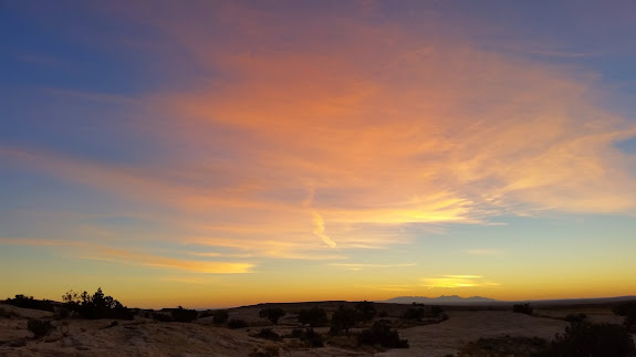
Last week I began an excellent five nights camped in the San Rafael Swell for my semi-annual geocaching event. On Tuesday after work I hitched the camp trailer onto the truck, loaded a few last-minute items, and drove south. It was just me and the dogs until Thursday when most everybody else arrived. Right at sunset I got to my camp site at the junction of the Goblin Valley and Temple Mountain roads. It looked as though it might storm so I waited until Wednesday morning to set up most of camp. Catching sunsets and sunrises turned out to be a favorite part of the trip. From camp I could see both the La Sal Mountains and Henry Mountains, each of which provided a nice backdrop for the dramatic light at the beginning and end of most days.
On Wednesday I hid some temporary caches for Saturday’s poker run. Many were within 100′ of a road, but a couple required some hiking. I hiked into a small drainage directly west of camp and went as far as I could upstream. I encountered a couple of dryfalls that required me to climb out of the canyon and re-enter farther up. At the “end” of the canyon was a slot that opened up into a very cool circular chamber. It had taken a bit of work to get there due to the dryfalls and some bushwhacking, so as I left I took a different route back to camp.
Later in the afternoon I did some exploring near camp and made a few nice finds. At first I found a broken arrowhead and an old corn cob, then I began to find broken grinding stones. After arranging and photographing pieces of four grinding stones and the corn cob, I found a very nice whole grinding stone. It was mostly hidden when I spotted it, and after photographing it I hid it quite well so that it wouldn’t walk off. I also spotted some pictographs that I’d been near many times but had never noticed them until now. There were two figures–one human and one animal–next to each other, and though faded and weathered, the pictographs appear to have been pretty nice in the past.
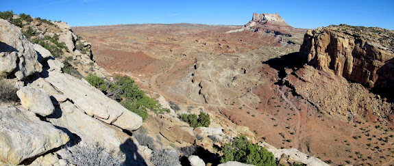
I started Thursday with a hike up what appeared to be an old mining road going up the San Rafael Reef on the south side of South Temple Wash. I’d scoped it out in Google Earth, though where the road ended I didn’t see any signs of mining from the satellite imagery. The old road was washed out but was still easier to follow than hiking cross-country. Along the way it occasionally offered great views over South Temple Wash. I reached the end of the road and at first didn’t see any indication of why the road was built. I hiked around a bit and began to find a few artifacts–mostly anchors in the ground with wire still attached. I assume at one point there was a repeater and antenna there that serviced the old Temple Mountain town site (some brief but good history explained here).
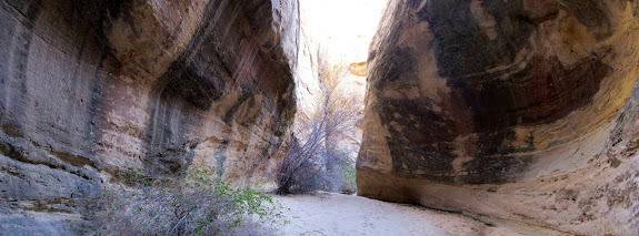
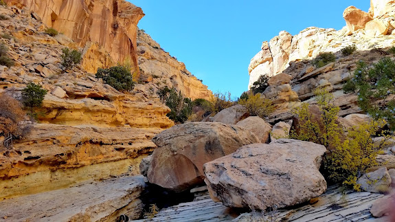
While hiking up the road I had looked behind me and saw an interesting canyon that I wanted to explore before heading back to the truck. I followed a wide, shallow drainage that suddenly became narrow and deep as the canyon descended the Reef. The canyon turned into a slot with a big dryfall below it, but I found a way around it and could see that the canyon was passable all the way back to the road. It was a lovely canyon and made for an interesting loop hike that I wasn’t expecting to do. At the bottom of the canyon I walked a short distance cross-country and hit the road just a few hundred feet from the truck.
By late that afternoon there were many more people at camp. There was a partial solar eclipse and I managed to capture it on camera in a lens flare and some shadows on the camp trailer. That evening’s sunset was brilliant and I spent some time on the hill above camp enjoying it.
Friday was a lazy day. I spent most of it at camp visiting with people. Chris G. and I took our families for a drive south past Little Wild Horse Canyon, hoping to reach Highway 24 and then loop back to camp on the pavement. The trip was cut short when Chris’ truck got stuck in the sand at a wash crossing and he realized that his 4WD wasn’t engaging. Some people camped 100′ from where he got stuck pulled him out before I turned around to find out why he wasn’t behind me any more. We decided since we had the Muddy Creek crossing to deal with if we continued, that we’d just turn around and head back to camp the way we’d come.
On Saturday almost everyone did the poker run that I’d set up earlier, so I went on a solo hike to try reaching a cave/alcove in the San Rafael Reef that I’d spotted from Highway 24 the previous day. I drove back to a spot on the highway from which I could see the cave, then drove back north while keeping my eye on the area near the cave until I was adjacent to it. I found a dirt road that got me closer to the Reef and it turned out to end at the trailhead to Wild Horse Canyon. I’d been in that canyon four times before so the first part of the hike was very familiar. I got to a point where I needed to climb out of the canyon on the north side to get closer to the cave. I hiked up a sandstone ramp and had a drop-off to my left and a cliff rising above me to the right. The drop-off to the left was part of a hollow in a side-canyon that had overhanging walls, pools of water, and a spring dripping at its head. I intended to check it out more closely on my way back down this route, and that time came very quickly. I reached a spot where the sandstone ramp I was on narrowed and sloped down to a vertical drop on one side. I felt like maybe I could traverse the sloping section to get to a wider spot beyond, but I didn’t want to risk it since I was alone and nobody knew where I was. I turned around and found my way into the hollow and explored beneath the overhangs and pools before hiking back out of Wild Horse Canyon.
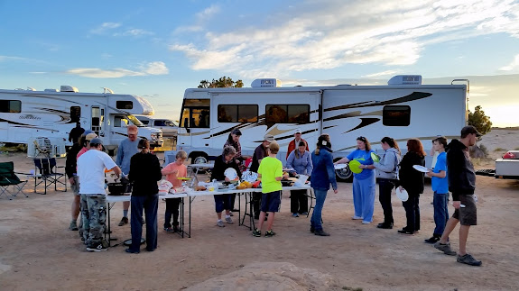
That evening at camp, after comparing poker hands and giving out prizes, we had a really nice potluck dinner. After we ate, the sky caught fire with a killer sunset. It was funny to see everyone grab cameras and phones to scramble up the sandstone hill above camp to capture the sunset. I enjoyed taking photos of the people as much as I did the sunset. Everyone enjoyed a nice evening around the camp fire, and we started a smaller fire away from camp in which to blow up gallon cans of vegetables. 😀 Later at night a few of us drove out to the paved road to take some night photos.
On Sunday most people spent the morning getting ready to head out. I left the day’s activities up to my kids, and they decided on hiking Little Wild Horse Canyon. I loaded up the family, my niece, and the dogs and drove to the trailhead where there were no available parking spots in the main lot. Despite all the cars at the trailhead, the canyon wasn’t terribly crowded. This was my third time hiking the canyon and the kids’ second, but it was Traci’s first. I didn’t think she’d make it all the way to the end of the narrows. I stopped often and asked her if she was okay going farther, and she kept pressing on. We all made it to the end of the narrows, only stopping a couple of times to allow groups to pass going the opposite direction. Going back down the canyon seemed to take half as long as going up. When we got back to camp there was only one other camp trailer left. We lounged around a bit longer while eating lunch, then packed up camp and drove home in the mid-afternoon.
The turnout for this event was better than in recent years. There were 33 people (and 14 dogs!) total, with three groups coming in from out of state–two from Grand Junction, Colorado, and one from Farmington, New Mexico. This is by far my favorite place to hold the event. There’s a lot to do in the area no matter your mode of transportation, and despite having camped there many times I keep finding new stuff each time.
Photo Gallery: San Rafael Swell, Fall 2014
GPS Track and Photo Waypoints:
[Google Earth KMZ] [Google Maps] [Gmap4 Topo]







Richard, this is where I was standing when you called me that day: https://lh5.googleusercontent.com/-FJn9CY3ntiw/VFLwNc89pwI/AAAAAAAAp-A/S-bQhrsJqWA/s640/IMG_8620.JPG
If I sounded surprised by your call, I was doubly surprised that I had cell service there. You were also the first person to call me on my new smartphone–my old dumbphone finally bit the dust and the new phone arrived a couple of hours before I left for this trip.
Readers may also notice that several of the photos from this trip report (those in the 16:9 aspect ratio) were taken with a camera phone. The Samsung Galaxy S5 takes decent photos compared to my Canon point-and-shoot. 🙂
Gotta’ ask….What’s up with the can of tomatoes and fire? Just good, ole’ fun??
Yeah, just some rednecks havin’ some fun. 🙂