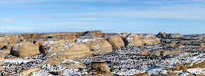
Yesterday I ventured into the heart of the San Rafael Swell to see firsthand how much snow was lingering. UDOT has a couple of webcams along I-70, one at Ghost Rock and another near Rattlesnake Bench, but it’s difficult to get a good idea of the conditions of any other roads in the area from those.
I left home and headed south on UT-10. It was foggy near Castle Dale, and all the trees and fences had hoar frost on them. The power plant wasn’t even visible from the highway due to the fog, but south of Castle Dale it cleared up enough to catch a glimpse of the smokestacks sticking up out of the fog. South of Ferron, I decided to take the Moore Cutoff Road rather than continuing along UT-10. It was the first time I’d been on that road since it was paved last year. I found a geocache about 50 feet off the road, but the snow was still deep enough there that I had to change into my snow pants and winter boots. The cache was near a boulder that contained some fossilized dinosaur bones. If it wasn’t for the deep snow, I would have hiked around and explored for more fossils.
 I stopped at the Eagle Canyon view area near I-70 and took some photos, then crossed the overpass to the other side of I-70 and tried taking the road down to Justensen Flats. I got to the end of the plowed pavement and decided not to even attempt the road. There was more than a foot of snow on the road, and I was surprised to see that absolutely nobody had been down it this winter with the exception of a couple of horses whose riders’ vehicle and trailer was still parked where the pavement ends and the gravel road begins. Other than those tracks, the snow on the road was flat and unbroken and had definitely not seen vehicular travel since the first big snow storm of the winter.
I continued east along I-70 and stopped at several of the view areas, then followed the interstate out of the Swell and exited at the UT-24 interchange. I drove north from the interchange along the county road, which was a mix of packed snow, slush, and mud. I was hoping to find a nice spot to stop for lunch, but there was nowhere to get off the road because of all the snow along the sides, so I made a multi-point u-turn and ended up eating lunch just off the interchange. Following lunch, it was still too early to head home, so I took UT-24 south until I hit the old UT-24 (now abandoned by the state and, I believe, a county road). It used to be a paved road, but it’s no longer maintained and has fallen into disrepair. Drainage along the road is poor, and there were several places where slushy, muddy runoff was flowing across the road. Most of the road was a mix of wet asphalt and packed snow and ice, and it was bumpy and slow-going. As I neared the Green River airport the road turned into thick mud, and I was heavy into the throttle trying to keep my truck going forward in 2WD–I didn’t want to step out into the mud to lock in the hubs. It was foggy at the airport and all the way into Green River, so I didn’t get to see much along the way (another good excuse to go this way again someday). From Green River, I took I-70 west then US-6 north and had an uneventful (and slightly drowsy) drive back home without making any other stops.
I only passed that stretch of I-70 once, but it’s definitely on my return list. It was on this trip…
http://richardbarron.net/galleries/jornada/
Maybe I’ll see you out there one of these years. -Richard