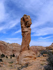
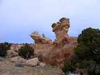
 I almost didn’t get out to play this weekend. The night before last (Sunday), I was considering a trip to Devil’s Hole the following morning, but scratched the idea because I didn’t think I’d have time to drive there, hike around, and make it back in time for Michael’s birthday party. When I woke up yesterday morning I knew that I’d regret not going, and though it was kind of late to start getting ready for a hike, I did it anyway. I was able to get all my gear (and breakfast) ready in about 30 minutes. Thankfully Mark was able to go on such short notice, and I picked him up at his house at around 9:30.
My original plan was to check out two possible hiking routes into Devil’s Hole. One route was a long shot, where in Google Earth it looked like it might be possible to scramble down some cliffs from a trail I’d ridden my ATV on last weekend. I wasn’t confident that it would be possible to get down from there, but if so, it would shorten the hike into the area. The other route looked pretty likely. In the satellite imagery, a horse/stock trail is visible that leads to the southwest corner of Box Flat, but it disappears for about half a mile across some sandstone. Another trail is visible on the other side of the slickrock in Devil’s Hole, but I was uncertain whether it was possible to hike between the two.
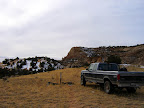
 We headed for the Box Flat route first because it looked the easiest. Shortly after leaving the graded dirt road and getting on the rocky trail to Box Flat, I noticed that the brake pedal in the truck was going all the way to the floor when I hit the brakes, and the brakes didn’t seem as effective as they should have been. I didn’t want to stop on the rocky, off-camber section of trail, so I kept driving until we got to some level ground. I looked under the hood and checked the level in the brake fluid reservoir, and it was half empty. I started checking behind the wheels of the truck to see if I was losing fluid somewhere, and sure enough it was gushing out of the left-rear brake drum. Since we were almost to our first destination, I kept driving south on Box Flat until we arrived at the WSA boundary–there was no point in turning back to go home. I knew that each time I pressed on the brake pedal I would lose more fluid, and I managed to drive the rest of the way without touching the brake pedal once.
 We left the truck and started hiking toward Devil’s Hole, unsure of what kind of terrain we’d have to cross in order to get there. I was expecting to do a lot of route-finding and scrambling down ledges, but in reality the hike was pretty easy and we quickly found where the trail picked up in Devil’s Hole. Since we’d made very easy work out of something that I had expected would take much longer, and because I knew that I wouldn’t be able to drive to the other hiking route with no brakes, we decided to keep hiking and see as much of the area as we could with the time that remained. We followed the trail west to the base of the big sandstone knoll that rises up out of the middle of Devil’s Hole, and from there the trail curved to the north. We didn’t have much time to explore, and the country to the south looked to be the most interesting, so we began hiking cross-country around the southern tip of the knoll. We rounded the tip and made it just far enough around to peek over into the valley to the west. There was a cliff just below us, and below that extended a flat valley that was about 3/4-mile wide, and it dropped off sharply to the south into the west fork of Red Canyon. It looked like some awesome country to hike in, but it would have to wait for another day. We also spotted a couple of possible ways to scramble to the top of the sandstone knoll, but those also will have to wait until I have more time.
The hike back to the truck was uneventful, covering the same ground we’d already seen. The drive home was a bit nerve-wracking. I drove from Box Flat all the way to the intersection of Main Street and 200 East in Price–a distance of just over 50 miles–without using the brakes. I had to use the brakes three times before I got to Mark’s house, and by then I had lost enough brake fluid that the brake warning light on the dash had turned on. My house is only a couple of blocks away, and by the time I got there I had almost completely lost the brakes.
The weather later this week is supposed to be nice, with highs in the upper 40s, and I’m planning on spending the next few evenings after work replacing both rear brake cylinders on the truck. Since I’ll have everything apart already, I’ll replace the brake shoes and all the springs, which I last replaced two and a half years ago. I’m hoping to get the job done before the weekend so that I can go play in the Swell some more. I may even go back to Devil’s Hole to take another look around.
Devil’s Hole Photo Gallery
Devil’s Hole Tracklog and Waypoints (in Google Earth KML format)