 When I was a kid living in Kenilworth, I heard a story from an unreliable source–a kid known for bragging–about an airplane crash that happened on the mountain northeast of town. I never knew whether to believe the story, but several weeks ago when I ran into an old friend near Kenilworth, he mentioned the plane crash. That was the first time I had even thought about it in probably 25 years, but strangely somebody else mentioned it to me just a few days after that. My curiosity got the best of me, and I started digging around trying to find out as much as I could about it. I asked my mom and my grandpa, and they confirmed that it did indeed happen, but all they knew was a rough location of where the plane crashed.
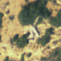
Short of finding somebody who had first-hand information about the exact location, my only other option was to scour the aerial photos on Carbon County’s website. Their site runs ArcIMS and it’s pretty slow and clunky, but the resolution of their aerial imagery is many times better than that in Google Earth. I spent several hours looking over an area roughly 0.6 miles long and 0.4 miles wide. I finally found something that could be an airplane, but nothing else even resembled something man-made. It’s not much to go on, but it’s the best I could do, so tomorrow Mark and I have plans to drive out there to see if we can spot the plane from the road. If so, or if we’re unable to determine for sure whether it’s there, we’re going to hike up to it. The site is 0.3 miles from the road in Cordingly Canyon and 700 feet higher in elevation. There are several bands of cliffs above and below the site, so getting there may be tricky. The hike might end up being 3/4-mile one way, but that’s still not too bad. We won’t be leaving Price until after 5:00 p.m., and hopefully we can make it back down to the car before dark. I’ve got my fingers crossed that we find the plane and that all the time I spent looking for it wasn’t wasted.