Category Archives: Book Cliffs

Moab Area

Sego pictographsI spent the second half of my four-day weekend in the Moab area. My goal was to find as many as I could of the dozen oldest geocaches in Grand County. Finding older geocaches usually gives me a lot of satisfaction. When geocaching first started, they were often placed in much more special places than they are now (it’s not uncommon to find them in parking lots and roadsides everywhere now). I left Price on Sunday afternoon (with Torrey this time–she was pretty excited to go since I’d left her behind for my Friday-Saturday trip) and made my first stop at the Sego rock art site in Thompson Canyon, east of Green River and just a few miles north of I-70. I knew if I spent too much time exploring the canyon that I would be setting up camp in the dark that evening, so I wasn’t able to give the place the attention it deserved. I looked at several rock art panels, then crossed the road and scrambled up a very steep and loose hill to find the geocache I was after. I then moved along farther east on I-70 and found a relatively uninteresting cache a couple of miles down a dirt road near a highway interchange. I backtracked just a bit and took the exit for UT-128, which was a wonderfully scenic highway.
Fisher TowersI stopped at Dewey Bridge to see the burned remains of the structure, and made one final geocache find for the day that required another steep scramble and had a nice view of the Colorado River. I had hoped to catch the sunset at Fisher Towers, but I was too late. I caught a nice view of the towers from several miles away just before the sun dipped behind the horizon. My plan was to camp along Onion Creek, where I’d never been and didn’t know what to expect. The canyon was pretty amazing, and the road was very interesting–it crossed the creek almost 20 times before I found a place to camp. I passed up the first six campsites, holding out for something with a better view, but after site #6 there were no more sites for quite a long distance. I finally came to the next campsite, which was occupied, and considered turning around there and setting up in one of the earlier sites, but I pressed on just a bit farther and found #8 to be empty. It was fully dark by then, and I started a campfire and set up my tent by the light of my headlamp. I ate a light dinner of ham and cheese wraps, wrapped in foil and heated in the fire, then read a book for a while before turning in.
Camp along Onion CreekI awoke Monday morning before the sun fully rose to see the campsite for the first time in daylight. It was a nice spot, but perhaps not as nice as those I’d passed up the night before. I had coffee and a bagel for breakfast while I took down camp. I was on the road by 8:30, and I stopped a couple of times on the drive out of Onion Creek to enjoy what I’d missed earlier. I met a couple from Colorado and their two kids at the bridge over the creek, and chatted for a while before moving along. I continued the drive along UT-128 into Moab, then took Kane Springs Road to the beginning of the Moab Rim Trail.
Moonflower CanyonI was relieved to see that the beginning of the trail was still shaded by towering cliffs that early in the morning, so most of the elevation I gained as I hiked up the Rim was out of the sun. My destination for this hike was Moonflower Canyon, though I stopped for two other geocaches along the trail. I didn’t know it at the time, but the first cache I found that day was my 1,500th find. When I reached the crest of the trail where it levels out and begins to turn from north to south, I stopped to eat a quick bite and enjoy a nice view of Moab. It wasn’t yet noon and I was getting hot. The trail curved south and then southwest, and along one slickrock section there was a pothole full of water that Torrey took a dip in. I eventually left the 4×4 trail and started down Moonwater Canyon, where it was an easy quarter-mile hike to a huge dryfall and the geocache. There wasn’t a great view from there, but I scrambled up to the canyon rim and hiked a bit farther west and was rewarded with a very nice view of the Colorado River. The entire hike back to the truck was hot, as the trail was no longer in the shade for part of the way. It was fun watching a few groups of Hummers tackle obstacles going up the trail as I made my way down.
Corona ArchBack at the truck I ate and drank, then headed back to Moab to cross the bridge and head down the Potash Road on the opposite side of the Colorado. I parked at the Corona Arch trailhead, just across from Gold Bar, and started up the foot trail. The geocache I was after was between the trailhead and Corona Arch, but after finding the cache I couldn’t pass up the chance to see Bowtie and Corona arches. I was surprised at how many people were on the trail for a Monday–I guess it’s prime tourist season around Moab. Even though there were a lot of people on the trail, the last of them cleared out just before I reached Corona Arch and I had the place to myself for a while.
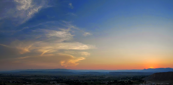
Sunset in Arches National ParkAfter visiting Corona Arch, I had three more geocaches that I wanted to try finding while still making it home at a reasonable time. All three were no more than a few miles off of US-191 north of Moab. The first was on the Klondike Bluffs trail, and I reached a spot about 0.4 miles from the cache where the long wheelbase on the truck prevented me from driving down off a ledge without getting hung up, so I parked it and hiked the rest. The area was nothing special–certainly nothing compared to everywhere else I’d been during the weekend–but Klondike Bluffs looked nice off in the distance. The second geocache was one of my favorites of the weekend. I had to do some serious 4-wheeling (serious for me, anyway–and I later found out this was part of the Copper Ridge trail used during the Jeep Safari) for about a mile to get within easy hiking distance of the cache. It was about another mile on foot from where I parked the truck, and along the way I crossed into Arches National Park. I hiked along a tiny slot canyon, which contained a few small water-filled potholes, to get into the park. My destination was Anniversary Arch, which I reached just at sunset. I snapped a few photos required to log the virtual geocache, then hiked back out as it gradually grew darker. It was full dark when I reached the truck, and I crawled back out of the area in 4-low. The last geocache I found was near the Copper Ridge dinosaur trackway. In the dark, there wasn’t much to see. I could only make out the dinosaur footprints because others had made small rings of rocks around the tracks. It was spooky finding the cache in the dark, especially since it was deep inside an overhanging alcove. All-told, I found eight of the dozen oldest geocaches in the county within two days. I even made it home in time to tuck my kids into bed. Thus ended an awesome weekend.


Photo Gallery
GPS Tracklog and Photo Waypoints (Google Earth .KMZ Format)
GPS Tracklog and Photo Waypoints (Google Maps)