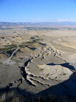
 I went and found a geocache overlooking Price today that was more fun than I’ve had in quite a while. Only two people had found it before me, and they both hiked up from the bottom with an elevation gain of about 500 feet. I wasn’t feeling up to a strenuous hike, but with the help of some up-to-date maps from Carbon County, I was able to drive my car to within two-thirds of a mile of the cache. The round trip hike ended up being 1.64 miles, and there was a lot of zig-zagging around trees and boulders, but the terrain was mostly flat. The views from the overlook were awesome. I could see Pinnacle Peak, Price, the San Rafael Swell, Cedar Mountain, and almost 180° of the Book Cliffs from Helper all the way to Green River. The drive home was nice because the sun was setting and the lighting and shadows were just pleasant.
Out of the 40+ geocaches that I’ve placed, I’ve only had one come up missing. A couple of days ago, the cache I had on the Helper Parkway came within a few inches of being destroyed by the Helper Interchange project. Luckily a construction worker apparently saw my disguised cache (it looked like a rock) and moved it to a safe location, away from the water line construction on the Parkway. I was able to go there and find it (thanks to the astute observations of a geocaching friend) and bring it home until the construction is complete. I put a lot of work into the cache container (though not too much expense), so I’m glad I was able to save it and the logbook.