
More than ten years have passed since I was last in this part of the San Rafael Reef. I’m not even sure what made me settle on this area for a hike this weekend, but I’ve had a waypoint for what I thought was some rock art for about eight years. Somebody had sent me some waypoints for non-rock art related things in the area, but this one point (that was probably included inadvertently) had a name that suggested there could be a rock art panel at its location. It was in an unusual location, not in a canyon but up high on the Reef along a ridge, so I wasn’t even confident of what I’d find there. The clocks had just been set back to standard time the previous weekend so I had an extra hour of daylight in the morning, but after getting up early and driving there I still didn’t begin hiking until well after 8:00 AM. The forecast called for sunny conditions all day but it was very overcast and dim all morning long.
Parking spot under cloudy skies

I crossed Cottonwood Wash and hiked up a small canyon into the San Rafael Reef. Where the old railroad grade intersected the canyon there were stone abutments and a separate raised grade that met the sides of the canyon at different points, as though they had changed their mind about where/how to get the railroad across.
Cottonwood Wash

Bushwhacking

Going up a small canyon

Railroad bridge abutment

Railroad bridge abutment and a larger fill beyond it

Due to a lot of impassable potholes and dryfalls I ascended the Reef by diagonally cutting across a few smaller canyons as they grew deeper the higher I went. I saw a lone bighorn sheep ahead of me, which in the past wouldn’t have worried me much, but after seeing Foresty Forest getting chased by a bighorn in the Swell (less than 20 miles from here) this same time last year it had me on edge. Luckily the ram climbed out one side of the canyon and my route took me up a ramp and out the other side.
Purple slabs

Going around a dryfall

Pool and cottonwood

Blurry bighorn

Small sandy wash

Climbing a ramp out to the rim

After some steep climbing I was above the canyon and could see the ridge where the waypoint was leading me. As I approached I could see a lot of patina but it took me a short while to discern the rock art. There were many Fremont style figures high on the cliff, all of them incised and abraded and relatively faint. The climb up to get a closer look was way beyond my abilities, and with the long distance and dim lighting I knew getting decent photos was going to be be a challenge, so I set up a makeshift tripod to hold my camera more steadily.
Heading up to that ridge on the horizon

Arrangement of thin slabs

Cliff covered in patina and faint glyphs

Makeshift tripod

Fremont style glyphs

Fremont style glyphs

Fremont style glyphs

Fremont style glyphs

Fremont style glyphs
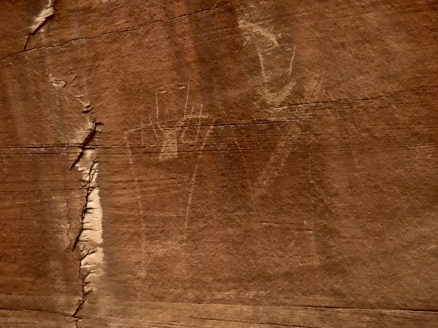
I rested, hydrated, and ate a snack at the base of the cliff before exploring the immediate area a little more. I found a shallow overhang with a mano, chert flakes, and charcoal on the ground. The sun began to come out as I was hiking back down the Reef along a different route, but I didn’t see anything else interesting the rest of the way.
Shallow overhang

Unusual mano

Arrangement of rocks

Broken point

Book Cliffs across the way

Mount Elliott

Large cairn

Small butte

Heading down a canyon

Railroad grade

Spring in Cottonwood Wash

On the drive back to the highway I stopped for a short one-mile hike to see a prospect that I’d noticed in Google Earth, and a nearby copper mine. The prospect had looked like a deeper hole in the satellite imagery but in reality it was quite shallow. The copper mine shaft was covered with timbers and, judging by the tailings pile, it was fairly deep.
Culvert under the railroad grade

Hiking to a mining prospect

Entrada Sandstone formations

Prospect

Copper mine covered by old timbers

Inside the copper mine

Tailings pile outside the mine

One last stop on the way home was near Trail Spring where there’s a monument to Joseph David Williams, who was found murdered there in 1976. As far as I’ve been able to find out his murder was never solved. From there it was a quick jaunt back to the highway and back home, ending a great day in the eastern San Rafael Swell.
Joseph Davis Williams memorial cross

Joseph Davis Williams memorial

Photo Gallery: Return to the Reef